Copyright and Compliance for Satellite Image Enhancement
In the era of big data and AI-driven analytics, satellite imagery is more valuable than ever. Companies across sectors-real estate, agriculture, logistics, and defense-routinely enhance satellite and remote sensing images to extract deeper insights. However, when AI tools are used to improve the resolution or clarity of these images, a crucial legal issue arises: Are you still compliant with the original licensing terms of the geospatial data?
This article dives into the often-overlooked legal aspects of satellite image enhancement, focusing on the importance of understanding the copyright and licensing agreements tied to geospatial data-especially when it's used for commercial purposes.
Part 1: Understanding Geospatial Image Copyright and Licensing Models

Satellite imagery is protected by geospatial copyright, which dictates how the data can be used, modified, or shared. These rights are held by the organization that captured the imagery-whether it's a government agency or a private satellite provider. There are two main categories of satellite imagery:
Public-domain imagery, often made freely available by government agencies such as:
- USGS Landsat(United States Geological Survey)
- NASA Worldview
- ESA (Sentinel-2 through Copernicus)
Commercial imagery, which is proprietary and typically requires licensing, such as:
- Maxar Technologies (formerly DigitalGlobe)
- Planet Labs
- Airbus Defence & Space
Just because an image is publicly accessible doesn't mean it's free to enhance or use commercially. Most commercial licenses have clauses that restrict redistribution, modification, or use in AI pipelines unless you have purchased the appropriate rights. Commercial imagery often includes detailed restrictions regarding:
- Resolution limits
- Distribution rights
- AI processing or derived data usage
Key Takeaway: Satellite imagery is not automatically free to use. Always check licensing terms, especially when using images commercially.
Part 2: Does AI Enhancement Create a New Work or a Modified Derivative?
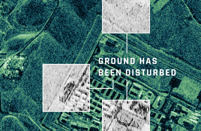
AI tools such as HitPaw FotorPea can dramatically improve image quality by:
- Perform super-resolution upscaling
- Denoise and clean artifacts
- Sharpen terrain and structure details
- Improve color and contrast
These transformations dramatically change the visual quality-but not the legal ownership. Enhanced images are still considered derivative works, especially when using licensed commercial imagery. That means they:
- Still fall under the original image's license.
- Cannot be redistributed or commercialized unless the license permits derivatives.
- May require additional authorization, especially for publishing or resale.
Key Takeaway: AI-enhanced satellite images are still tied to the legal status of the original image. They are not independent assets. Enhancing resolution through AI may trigger higher licensing obligations.
Part 3: Public Domain vs. Licensed Imagery-Know Your Source
Before using any satellite image, determine whether it is:
- Public domain, meaning free to use with or without attribution.
- Restricted use, meaning subject to licensing agreements for commercial applications.
Safe, open sources include:
- USGS Landsat: Global coverage, 30m resolution, no commercial restrictions.
- ESA Copernicus (Sentinel-2): Free and open under the EU's data policy.
- NASA Earthdata: Available for public use with attribution.
Commercial providers that require licenses:
- Maxar Technologies: High-resolution Earth imagery with strict redistribution policies.
- Planet Labs: Offers daily imagery with tiered licensing for business use.
- Airbus Defence: Licenses aerial and satellite images with firm usage rules.
Key Takeaway: Public-domain sources are safe for enhancement. Commercial images require careful rights verification-even if they appear on public-facing websites.
Part 4: Commercial Use Cases That Must Be Extra Cautious
Businesses across industries rely on enhanced satellite images to improve insights and create products-but not all of them understand the copyright implications.
Example 1: A real estate company takes a licensed Maxar image with 0.5m resolution and uses AI tools to enhance it to 4K, then integrates it into their app. This use likely exceeds the original license and may require a commercial or "value-added product" license.
Example 2: A cartographer uses USGS Landsat imagery, enhances it with AI, and sells printed maps online. This is legal, but only if attribution is provided and the sale complies with public domain terms.
Example 3: A defense contractor enhances high-res imagery from a commercial provider to improve terrain detection. Many commercial satellite contracts specifically forbid image processing or AI analysis without written consent.
Industries that should be especially careful:
- Real estate and land development
- Environmental and climate analytics
- Logistics and transport modeling
- Military intelligence and disaster response
Part 5: How to Use AI Tools Responsibly for Satellite Image Enhancement
HitPaw FotorPea is a powerful AI-driven tool designed for users who need precise and professional image enhancement. While it offers a wide range of capabilities:
- Super-resolution AI upscaling
- Deblurring and dehazing
- Structural detail reconstruction
- Terrain and topographic feature enhancement
Best Practices for Legal Use AI Tools:
1. Verify the Source Before Enhancement
Only use imagery that is public domain or properly licensed. Document the source and applicable license terms for compliance.
2. Understand the Usage Rights
Look for clauses around "derivative works" or "value-added products." Don't assume modifications release you from licensing restrictions.
3. Use Enhanced Images Internally-Unless Licensed Otherwise
Keep AI-processed data within the scope of the original contract. Avoid public sharing, commercial resale, or media use without extended permissions.
4. Provide Attribution Where Required
Even public domain images may require source acknowledgment.
5. Engage with Licensing Teams When in Doubt
Reach out to data providers to clarify whether enhancement is permitted.
FAQ: Geospatial Image Licensing and AI Enhancement
Q1. Can I legally enhance USGS Landsat images for my company's analytics reports?
A1. Yes, USGS Landsat images are in the public domain and can be used, enhanced, and even redistributed freely-with attribution recommended.
Q2. I used AI to improve a Maxar satellite image and posted it on LinkedIn. Is that legal?
A2. No, not without a commercial redistribution license from Maxar. Enhancement does not exempt the content from its original legal framework.
Q3. Do derived data clauses apply even if I'm not reselling the image?
A3. Yes. Most clauses apply to any modification, including internal reports, external presentations, or publishing-even if you don't sell the data.
Q4. Where can I find open satellite imagery that's safe to enhance?
A4. Use sources like USGS (Landsat), NASA Earthdata, and ESA Copernicus. Always verify terms of use on their websites.
Conclusion: Stay Legal While Enhancing Satellite Images
The line between technical innovation and legal compliance is growing thinner in the age of AI-enhanced satellite imagery. Tools like HitPaw FotorPea provide impressive capabilities, but users must still respect the boundaries of data ownership. Whether you're sharpening satellite imagery for internal analysis or preparing visuals for a public-facing product. In geospatial work, legal clarity is just as important as visual clarity. By staying compliant, your organization can unlock the full power of geospatial insights, without the legal risk.





 HitPaw Univd (Video Converter)
 HitPaw VoicePea
  HitPaw VikPea (Video Enhancer)


Share this article:
Select the product rating:
Daniel Walker
Editor-in-Chief
This post was written by Editor Daniel Walker whose passion lies in bridging the gap between cutting-edge technology and everyday creativity. The content he created inspires the audience to embrace digital tools confidently.
View all ArticlesLeave a Comment
Create your review for HitPaw articles